To celebrate Earth Day, we wanted to share some of the innovative ways the Iridium® network is supporting polar scientific research and environmental monitoring applications in the polar regions. As the only communications network that provides reliable, truly global coverage, Iridium’s unique network architecture makes it the provider of choice from pole-to-pole.
Iridium is uniquely qualified to bridge the scientific and business communities due to its one-of-a-kind service coverage in the Arctic and Antarctic, helping researchers improve their assessments by providing real-time data for tracking sea levels, temperatures, water salinity, composition of the atmosphere, and more. In fact, new data is being collected and analyzed on an almost daily basis to help scientists study the climate, weather, geology and wildlife of these unique regions.
Iridium leverages our 450+ partners’ specialized knowledge and resources to deliver innovative solutions to users across a diverse set of industries around the globe. Our partners have created some of the world’s most innovative polar loT solutions in operation today, all powered by our unique pole-to-pole satellite constellation.
Here are just a few examples of the unique applications and ways the Iridium network is supporting connectivity in the polar regions:
Autonomous Underwater Vehicles
The Woods Hole Oceanographic lnstitute‘s SeaBED AUV (autonomous underwater vehicle) ‘Jaguar‘ helped produce the world’s first detailed, high-resolution 3-D maps of Antarctic sea ice. This is useful for marine biological, geological, and archaeological applications that all share the need for high resolution optical and acoustic imaging of the seafloor1.
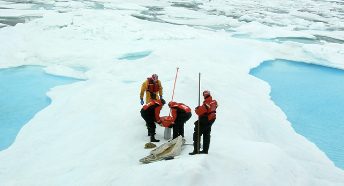
Remote Weather Stations
The MetOcean Polar Automated Weather Station, also known as PAWS, takes measurements of air, ice and ocean temperatures, along with snow depth and ice thickness. It utilizes the Iridium network to send aggregated data from a variety of sensors, including acoustic snow depth sounders, air temperature probes, and acoustic ice sensors located below the arctic ice.
Another solution from Iridium partner MetOcean is the Polar Ocean Profiling System, also known as POPS. POPS is an ice platform, which logs and transmits meteorological and oceanographic data. The design is compact and lightweight to allow for easy deployment. Data is transmitted in real time over the Iridium network, providing critical information from regions where no other communications path is as reliable as Iridium.
Ocean Buoys
The UpTempO from MetOcean is an Iridium network-based reporting data collection and processing system, designed for oceanographic and polar applications. The system can operate unattended in the harshest of climates and conditions. Another solution by MetOcean is the Surface Velocity Program (SVP, iSVP), a compact polar weather station that is air-deployable, buoyant, ruggedized, and ideal for remote and harsh environments. It was developed to assist meteorological and oceanographic scientific communities and transmits sensor data crucial for weather forecasting.
Ice Mass Balance Buoys, installed by the U.S. Army Corps of Engineers, measure the Arctic sea ice cover. Designed for multi-year service, the Seasonal Ice Mass Balance Buoy (SIMB) program was developed in response to the recent dramatic shift to a younger, thinner ice cover. Data is collected and transmitted back through the Iridium network to provide knowledge needed for insight on fundamental sea ice thermodynamic processes to help researchers understand complex atmospheric-ice-ocean interaction.
Wave Measurement Buoys, installed by the Office of Naval Research’s Sea State mission, measure wave movements in the western Arctic Ocean. Four types of buoys were released and monitored over 1-3 days: SWIFT (by APL-UW), Wave Buoys (by Polar Scientific, Ltd), Wave-Ice buoys (by NIWA), and Waverider G4 (by Datawell) to produce valuable scientific measurements to increase fundamental knowledge and provide technology options for future naval capabilities and systems.

Ocean Profiler Buoys are deployed by the North Pole Environmental Observatory (NPEO) to monitor environmental changes at camp Barneo in the upper Arctic Ocean. The buoys transmit throughout the harsh winter months and provide researchers with valuable real-time temperature and salinity data using the Iridium satellite constellation.

Autonomous Ozone Buoys are stationed on the Arctic sea ice to measure ozone levels, bromine monoxide radicals, CO2, and other parameters, for up to a year without human intervention. The O-Buoys relay data back to land every hour via satellite. Having access to real-time data is vital for chemical and organic research and can only be achieved using the Iridium satellite network.
Exploration
One of the best ways to celebrate Earth Day is to get out and explore our beautiful planet. Iridium employee Sam Wright visited Antarctica and stayed connected with an Iridium GO!® device. This allowed him to enjoy visiting the icy continent for the first time knowing he could get in touch with family and friends at home.

Explorer Colin O’Brady stayed connected with Iridium when he successfully completed The Impossible Row – the world’s first completely human powered ocean row across Drake Passage – from the southern tip of South America to Antarctica. Iridium was the only option to keep Colin and his team connected on this dangerous expedition.

To learn more about Iridium in the polar regions, visit: https://www.iridium.com/solutions/polar/